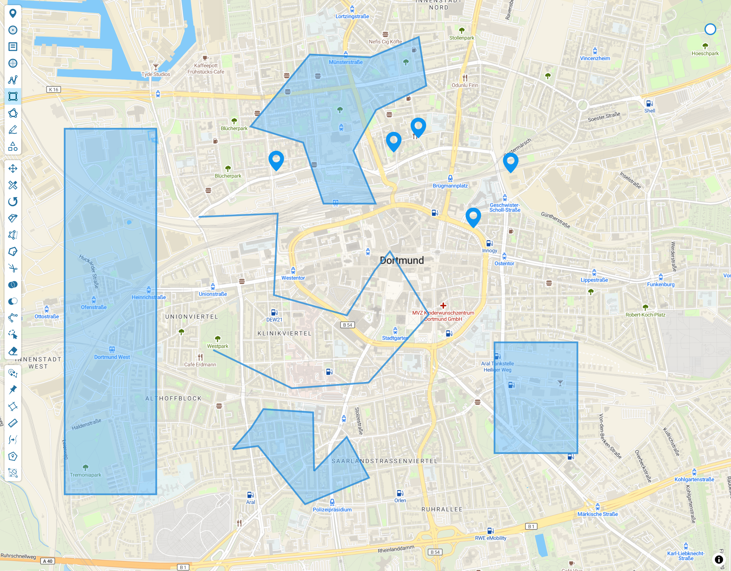

Today, we are thrilled to announce Geoman for MapLibre, a major release that brings all the geospatial tools you know from our Leaflet integration to MapLibre. For over a decade, Geoman has been empowering developers with intuitive and powerful tools for managing geospatial data. Now, MapLibre users can also leverage these features to enhance their applications, making it easier to build interactive, data-rich maps for web applications across a wide range of industries. For developers looking to add advanced geospatial editing capabilities - such as drawing, editing, snapping, and measuring - to their MapLibre projects, Geoman for MapLibre is an exciting new solution.
Geoman's Journey and the Evolution of Web Mapping
Geoman started over a decade ago as an open-source project within the Leaflet mapping ecosystem. Initially, our goal was to help developers handle data objects on Leaflet maps with ease and flexibility. Over the years, Geoman's functionality has expanded significantly, evolving from simple editing tools to a comprehensive suite of advanced geospatial features. Today, Geoman offers capabilities like auto-tracing, spatial analysis and measurement that streamline complex workflows and empower companies and development teams to build powerful, modern geospatial applications faster.
As Geoman has evolved, so has the way that our users make web maps. Leaflet remains a popular choice, but we have seen a growing demand among our client base for features like WebGL acceleration and 3D rendering. These capabilities unlock more immersive, high-performance maps that modern applications increasingly require. One library meeting these needs is MapLibre, an open-source, community-driven fork of Mapbox. MapLibre is emerging as a popular choice for developers seeking high-performance, customizable maps with the added benefit of WebGL for smoother, interactive experiences and the flexibility to render 3D elements within one code base.
To meet these needs, we recognized that extending Geoman to the MapLibre ecosystem was the natural next step. With the announcement of MapLibre-Geoman Free and MapLibre-Geoman Pro this has been accomplished. Both products maintain feature parity with their Leaflet counterparts - Leaflet-Geoman Free and Leaflet-Geoman Pro - ensuring that MapLibre users can access the full range of Geoman’s tools regardless of their project size or scope. MapLibre-Geoman Free is ideal for smaller projects and hobbyist developers, while MapLibre-Geoman Pro is designed for advanced business use cases and super users needing additional features and support.
What Geoman Brings to MapLibre
The situation today in MapLibre is similar to the state of Leaflet prior to the introduction to Geoman, namely the lack of a powerful and professionally maintained geospatial data solution. With Geoman for MapLibre, you will have access to a full suite of tools designed to make geospatial data management simple, powerful, and intuitive. Here are some key features Geoman brings to MapLibre:
Free version features
- Drawing tools: Add shapes like polygons, circles, markers, and lines directly onto your MapLibre maps
- Shape editing: Resize, rotate, move, or modify shapes with ease
- Snapping: Precise shape placement with snapping options for alignment, making it easier to draw complex polygons
Pro version features
- Scale mode: enables the resizing of polygons while maintaining shape
- Split mode: allows you to draw a line that divides all underlying polygons and polylines
- Pinning: when dragging a vertex/marker, you can pin all other markers/vertices that have the same lat/long to the dragged marker.
- Measurement: calculates the measurement (e.g. length, area) of a layer while drawing and editing.
- Autotracing: while drawing / cutting it is possible to auto trace the coordinates of another layer.
- Performance: options to enhance performance by significantly reducing DOM nodes, facilitating smooth editing with large datasets.
- Ortho Snapping: gives the ability to effortlessly draw 90° angles
- Spatial Analysis tools: Union and Difference tools for polygon intersections
- Line simplification: Simplify line geometry by removing vertice
- Lasso mode: Free hand selection
- Customer support and access to product specialists available depending on subscription
These tools simplify the web mapping development process, allowing you to seamlessly incorporate advanced geospatial capabilities into your MapLibre projects.
Use Cases and Industry Applications
Geoman for MapLibre unlocks new possibilities for diverse industries. Here are some examples of how various sectors can leverage these tools:
- Real Estate: Real estate software can benefit from interactive maps that allow users to mark property boundaries, measure land size, and visualize residential installations (e.g. solar installations).
- Utilities: Utility companies can map infrastructure locations, measure distances between assets, and plan utility lines with precision.
- Land Management: Environmental projects can benefit from mapping protected areas and designating boundaries for specific regions.
Getting Started with Geoman for MapLibre
It is straightforward to get up and running with MapLibre-Geoman, just head to our documentation to learn how to get started. We will release more examples on how to get up and running in your Next, Vite frameworks over the coming months. We are priorizing developer experience and our comprehensive documentation makes it easy to go from setup to implementation and start building powerful mapping applications.
Pricing and Availability
MapLibre-Geoman Free and Pro are available to developers of all project scales. The Free version is ideal for smaller, non-commercial projects, while the Pro version is tailored for business-level use cases and offers additional features. For more information on licensing and pricing, please visit our pricing page.
Geoman-MapLibre will also work for Mapbox users
As MapLibre is a fork of Mapbox, we have designed Geoman-MapLibre to also support Mapbox customers and their use cases. So if you build maps using Mapbox, make sure to check out Maplibre-Geoman and its functionality as described in this blog post to see how we can help your web mapping needs.
We are excited to see how you will use Geoman’s tools in MapLibre to create new, innovative applications. If you want to discuss specific use cases and need guidance, shoot us an email at [email protected].

